Fort Nelson First Nation Villages
A Nation, A People - Strong, Healthy, Proud, Self-reliant
"For as long as the sun shines, the grass grows and the rivers flows"
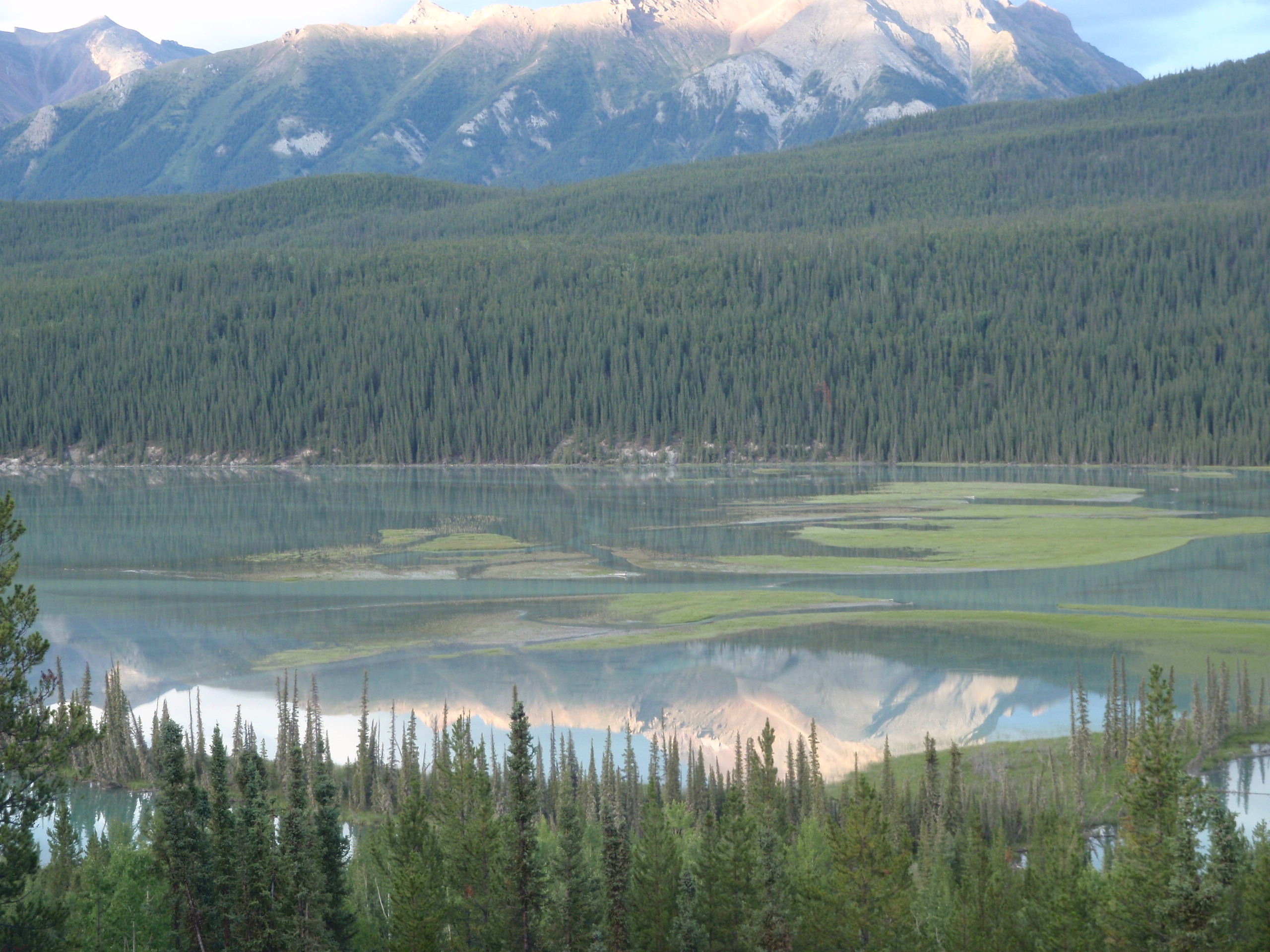
We are the “People of the Land" and have occupied the lands of northeast of British Columbia for tens of thousands of years. Our people speak the Dené and Cree languages and have a deep connection to the land. We were, and still are, hunters and gatherers and our people moved around the territory with the seasons and animals that sustained our way of life and livelihood.
Our people came from different areas of the territory. Fort Nelson was not FNFN’s original home. The Old Fort, on the banks of the Fort Nelson River, was just where FNFN came to trade furs and purchase goods at the Hudson Bay Post.
Our people came from different areas of the territory: Nelson Forks, Francois, Pretty Hill, Deer River, Snake River, Kotcho, Fontas, Kahntah and Moose Lake. Some of our relatives even came from as far away as Alberta and the Northwest Territories, and they were adopted into our Nation by our elders.
Chief Jimmie Badine and Headman Tommy Whitehead signed our adhesion to Treaty No. 8 on August 15, 1910 at the Old Fort. The 1910 Treaty talks affirmed FNFN’s rights to our traditional lands and ways of life “for as long as the sun shines, the grass grows and the rivers flow.” In the spirit of our Treaty of peace, sharing and co-existence, we welcome others to our territory with the expectation that they will respect our lands, our ways and the intent of our Treaty.
FNFN did not get our “reserve” until the early 1960’s, (50 years after signing our Treaty) at which time most of us were moved to “Mile 295” of the Alaska Highway. At that time, some of our families remained and continued to live on the land where their families had lived for generations.
FNFN has just over 700 members and 10 reserves. Our total reserve land base is 9556.5 hectares. IR #2 is the largest and is located at Mile 295 off the Alaska Highway. This is our main reserve and home to about half of our population. There are about 160 houses on IR #2. Facilities include an administration office, justice department, Chalo school, daycare/headstart, lands office, adult learning centre, health centre, cultural arbor and capital works. We also have reserves at Fontas, Kahntah, Snake River, Moose Lake, Francois and Maxhamish Lake.
Many generations of our men, women and children have lived and thrived in this area. FNFN has a commitment and obligation to care for and protect our rights, our lands, our waters, our animals and the whole ecosystem for future generations.
FNFN Community
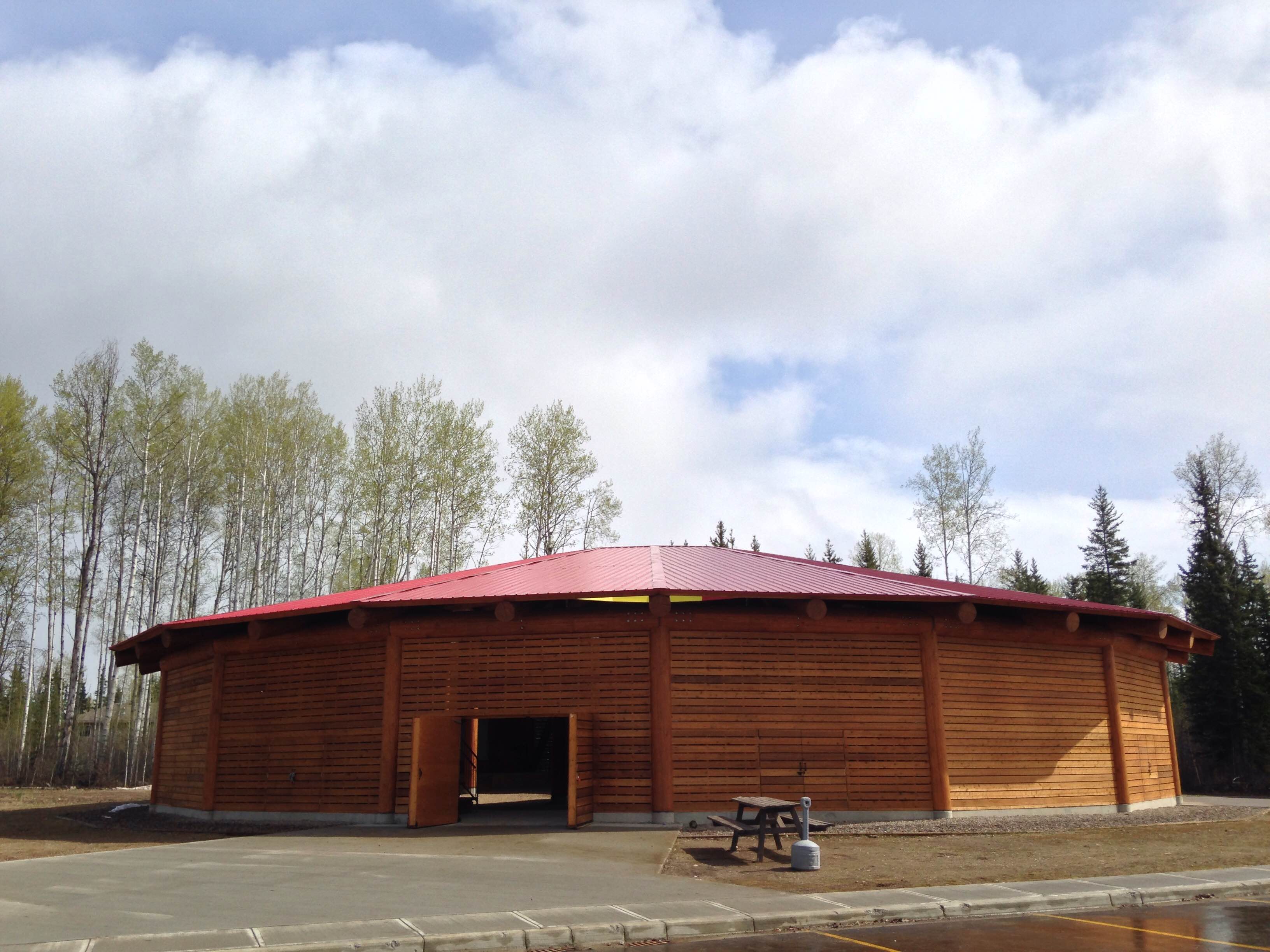
The community of FNFN IR #2 is located 7km south of the town of Fort Nelson at Mile 293-295 on the Alaska Highway. In 1959, the Federal Government created FNFN IR #2. By 1961 many FNFN families moved from out on the territory to FNFN IR #2 to raise their families, be closer to schools and services, and to have more economic opportunities. By the end of the 1960s most FNFN members had moved to FNFN IR #2.
Fóndąkų́e / Fontas
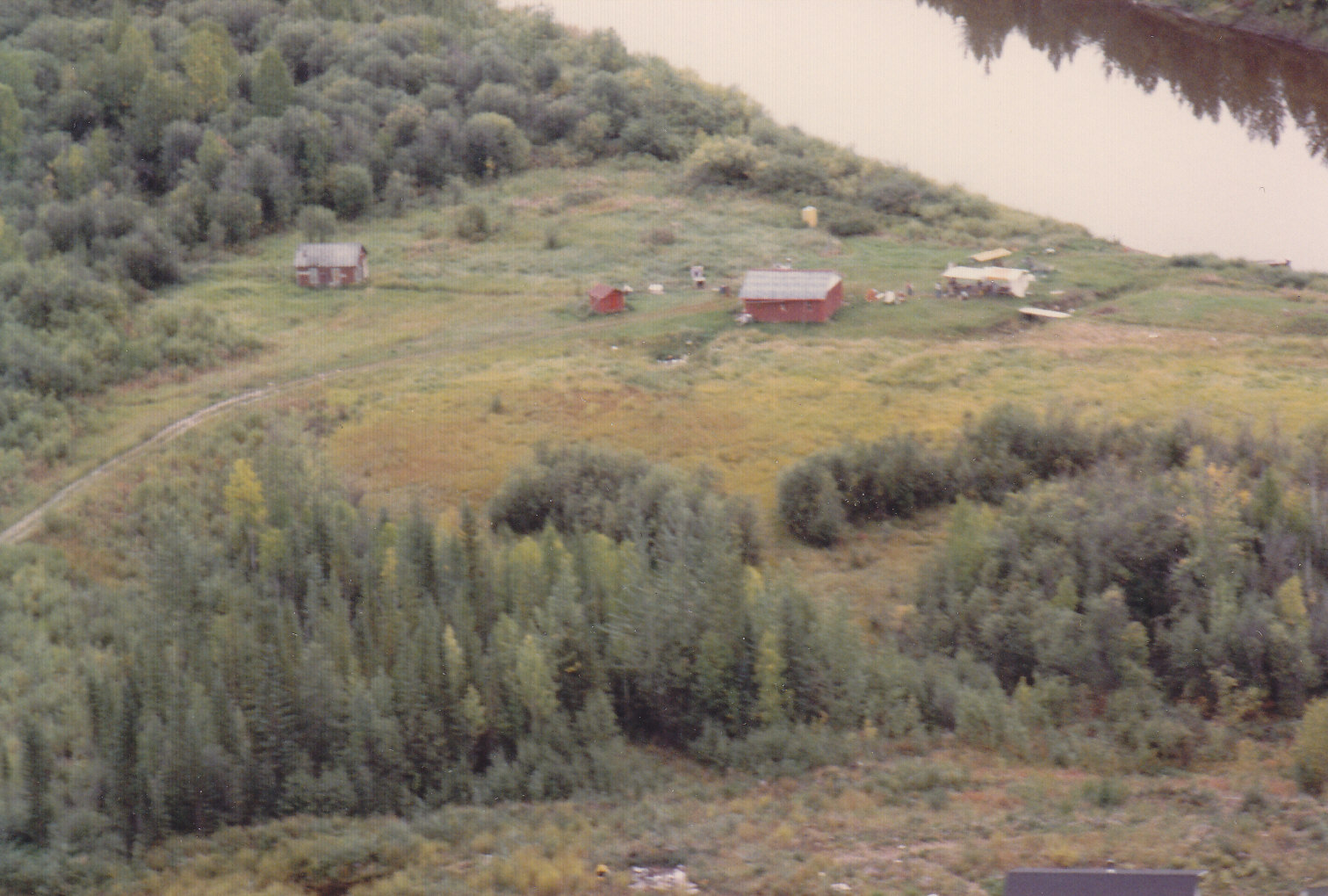
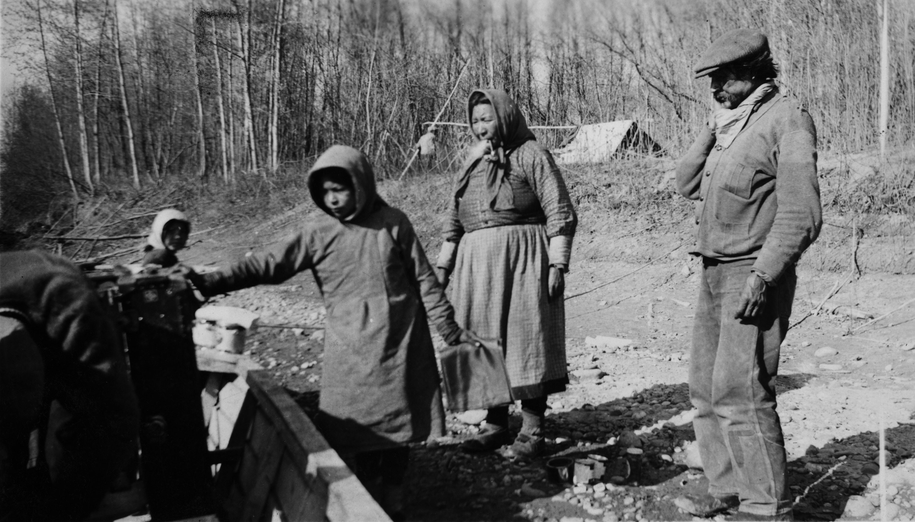
The village of Fontas sits on the northern edge of the Fontas River near the confluence of the Sikanni, Fontas and Sikanni Chief Rivers. At one time many families lived at this village, but currently there is only one family living there year round.
In the summer months, families travelled by horseback, canoe or riverboat to Kahntah and Old Fort Nelson to visit family and get supplies. In winter, they travelled by dog sled team or skidoo.
Fontas was, and still is, a gathering place for hunting, trapping, fishing, and plant harvesting. During the summer months, many families grew gardens along the lower river terrace.
In 1970-71 a rail line was constructed between Fort St John and Fort Nelson. The railway line came within 2 km of Fontas, and for many years was used by the families living in Fontas to travel to and from Fort Nelson or to send or receive supplies. One elder even had their truck delivered on the railway line!
Góchók’ęh / Kotcho Lake
The village at Kotcho Lake is located at the southeastern edge of the lake at the mouth of the Kotcho River. Presently there is only one cabin still standing at the village site. FNFN elders tell us that Kotcho Lake was a gathering place on the overland trail between Fort Nelson and Assumption.
A 1913-14 map drafted by BC Land Surveyor G.B Milligan shows that as well as this site, there were two more gathering places at Kotcho Lake – a campsite area on the northeast corner of the lake, and a fish processing and cache site on the northwest corner.
There are also two islands in Kotcho Lake. Both show past and present signs of habitation and spiritual practices. Currently, Kotcho Lake is used seasonally as a gathering and recreation space.
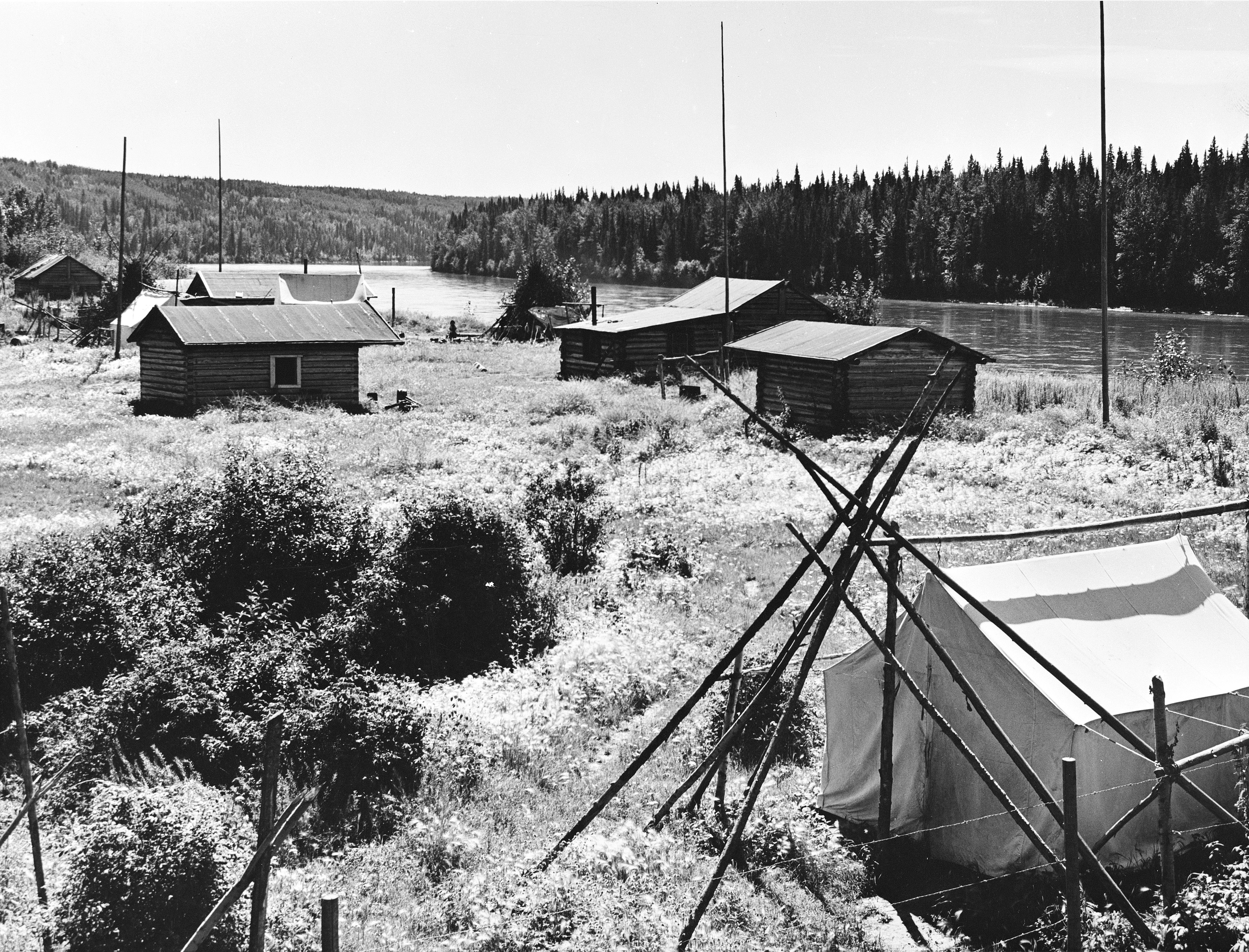
Chátęh Kų́e / Old Fort Nelson
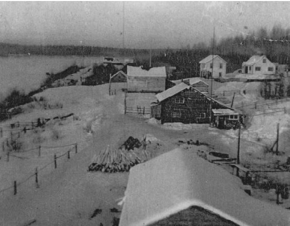
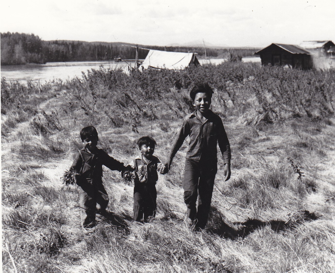
The village of Old Fort Nelson (“Old Fort”) is located on the eastern banks of the Fort Nelson River. Tthek’enneh Kué means village of the Sikanni people. The village was once a gathering place for Dené and Cree people from villages all along the Muskwa, Nelson, Liard, Sikanni and Fontas Rivers, from up north in the Northwest Territories, and from out east in Alberta.
Many FNFN families lived at Old Fort year-round or seasonally, and the village was a home base for hunting, trapping, fishing and harvesting activities, and a gathering place for feasts and celebrations. These activities are still based out of Old Fort today with some members still living there full-time, and others accessing the site throughout the year.
Prior to the 1960s, Old Fort had an operating Catholic Church and school, several stores, a HBC trading post, a dance and pool hall, restaurants and many houses. Many families in Fort Nelson can still trace their childhood to living at Old Fort.
Kahntą́h Kų́e / Kahntah

The village of Kahntah is located at the confluence of the Fontas and Kahntah Rivers. In the past, many families lived at Kahntah year-round, and currently one family still lives there seasonally.
The village is a home base for hunting, trapping, fishing and harvesting activities focused around the village site, north towards Ekwan Lake and west towards the village of Fontas.
Many unmarked graves surround the village as a Tuberculosis epidemic came through in the 1940-50s.
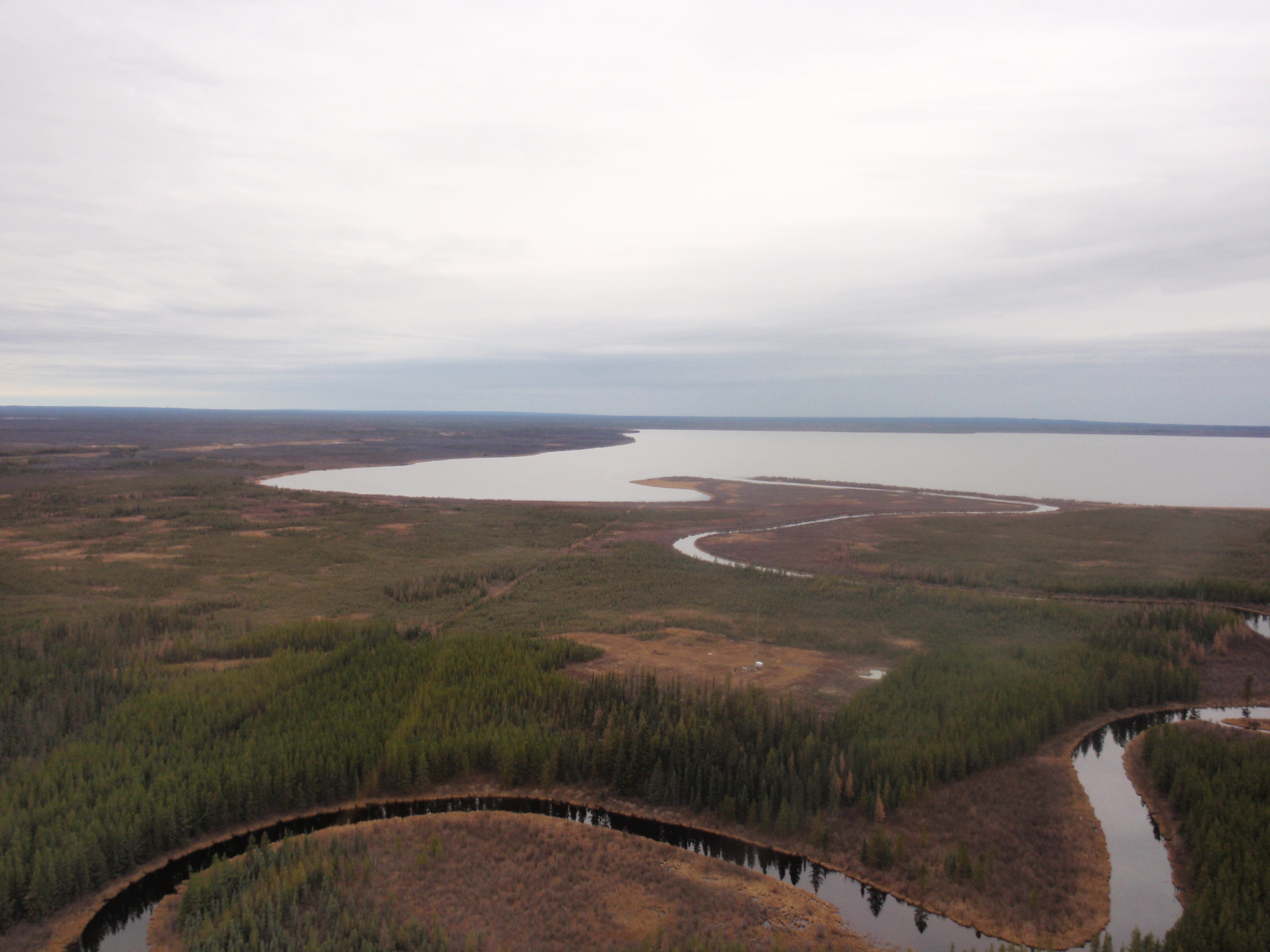
Nádú Deehe / Snake River
The village of Snake River is located where the Snake River flows into the Nelson River. The river got that name because the meander of it reminded people of a snake slithering along the landscape.
At one time many families lived at this village site. Currently, Snake River remains a gathering place for FNFN members to camp, hunt, fish, trap, pick berries and practice cultural activities.
In summer, families travel along the river or take a nearby logging road to get to the village. In winter, travel by skidoo or winter road is used.
Stories from our elders tell that Snake River once had many cabins, gardens, horse trails, wagon roads, and horses, and evidence of those features can still be seen today, partly because of its close distance to Fort Nelson.
The village continues to be used by FNFN members, and is used as a stop-over point for hunting/guiding activities along the Fort Nelson River.
Medzı́h Deehe / Deer River
The village of Deer River is located where the Deer River flows into the Fort Nelson River. People have always lived in the Deer River area, but at one point a flu epidemic forced community members to abandon the site.
Deer River is known as an area to gather year-round and seasonally to hunt, fish and trap around the village site, and it is still used today by members exercising their treaty rights.
At one point, there used to be 7 or 8 cabins at Deer River, many with their own gardens and areas for processing meat and fish.
Deer River was also known as a spiritual place, where yearly tea dances would have been held.
Łı́dı́ı́kų́e / Nelson Forks
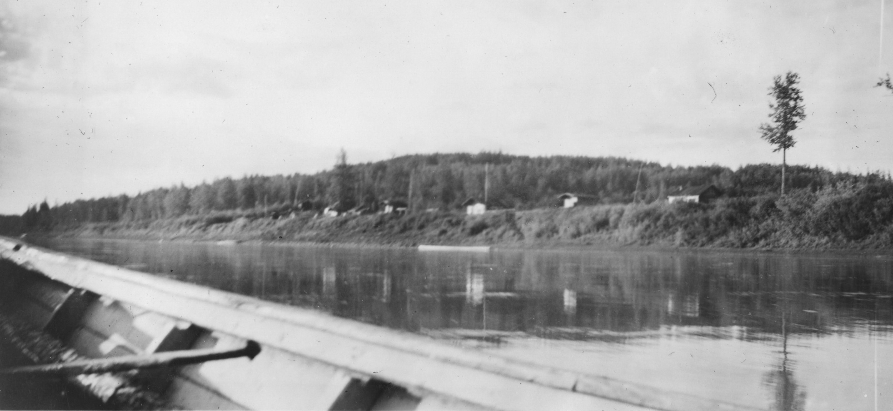
The village of Nelson Forks is on the eastern edge of the Nelson River, just south of the confluence of the Nelson and Liard Rivers. In Dené the village’s name is Łidli means the joining of two rivers.
Many FNFN families and those from neighbouring nations lived in this village year-round, or as part of a seasonal round between Nelson Forks, Pretty Hill, Francois and Maxhamish Lake.
Nelson Forks was a hub for game, fish and vegetation harvesting activities, as well as a spiritual, teaching and gathering place.
In the 19th century the Hudson Bay Company opened a trading post at Nelson Forks. Currently, Nelson Forks is used seasonally as a gathering space for FNFN members, and those of neighbouring nations.
Łúę Túę / Maxhamish Lake / Fish Lake
The village at Maxhamish Lake is located on the southeastern shore of the lake. Maxhamish Lake is also known as Fish Lake or Sandy Lake.
Many FNFN families and those of neighbouring nations lived there year-round or seasonally as part of a seasonal round between Nelson Forks, Pretty Hill, Francois and Maxhamish. One FNFN elder recalls boating from Pretty Hill to Francois, walking to Maxhamish Lake to hunt, trap, fish and collect plants for medicines, and then walking back to Pretty Hill via overland trail. Although the main village site is on the southeastern shore, there are stories of gathering places and burials all around the lake.
Currently, FNFN has four reserve parcels around the lake, and many members have cabins they visit seasonally.
Gólómı́ę / Moose Lake
The village of Moose Lake is located on the eastern shore of Moose Lake. Moose Lake is south of Muncho Lake and is accessed today by overland trail or boat.
Only one FNFN currently lives seasonally at Moose Lake, but there would have been many families from FNFN and other neighbouring nations using the village site over the years.
Moose Lake was a home base for hunting, trapping, fishing and harvesting activities. Large game – moose, sheep, elk and caribou – was hunted near the village, and still is today by community members and guiding operations.
Dę́ę́htthı́hlę / Pretty Hill / La Jolie Butte
The village of Pretty Hill is located on the eastern side of the Liard River between the villages of Nelson Forks and Francois.
Pretty Hill is also known as La Jolie Bute, as the village is set on a bluff overlooking the river. Pretty Hill was a small settlement, with only a few families living there year-round, with many families travelling through the village as part of a seasonal round between Francois, Maxhamish Lake, Nelson Forks and Pretty Hill, or as they journeyed along the Liard and Nelson Rivers.
Currently, Pretty Hill is used seasonally as a gathering space for FNFN members, and those of neighbouring nations.
Tlı̨́góché / Francois
The village of Francois is located where Sandy Creek flows into the Liard River. Also known as Franceways, the settlement was small with only a few families living there year-round or as part of a seasonal round between Maxhamish Lake, Nelson Forks, Pretty Hill and Francois.
The Hudson Bay Company had a small store at the Francois settlement that sold supplies and collected furs from hunters and trappers. The store was only in operation seasonally after the spring and fall hunts. Most operations were conducted upstream at the Nelson Forks HBC post.
Currently, Francois is used seasonally as a gathering space for FNFN members and those of neighbouring nations.
Contributors
Photo courtesy of:
Fort Nelson First Nation Lands Department, the personal collections of Renee Lomen, Sharon Sopel, Curtis Dickie, Suzanne Rees, Lana Lowe, the Fort Nelson Library, the Hudson Bay Company Archive and the Royal BC Museum-BC Archives.
Village Storymap:
Bobby Concepcion
Geospatial Services
FNFN Lands Department
Content:
Jennifer Coupe